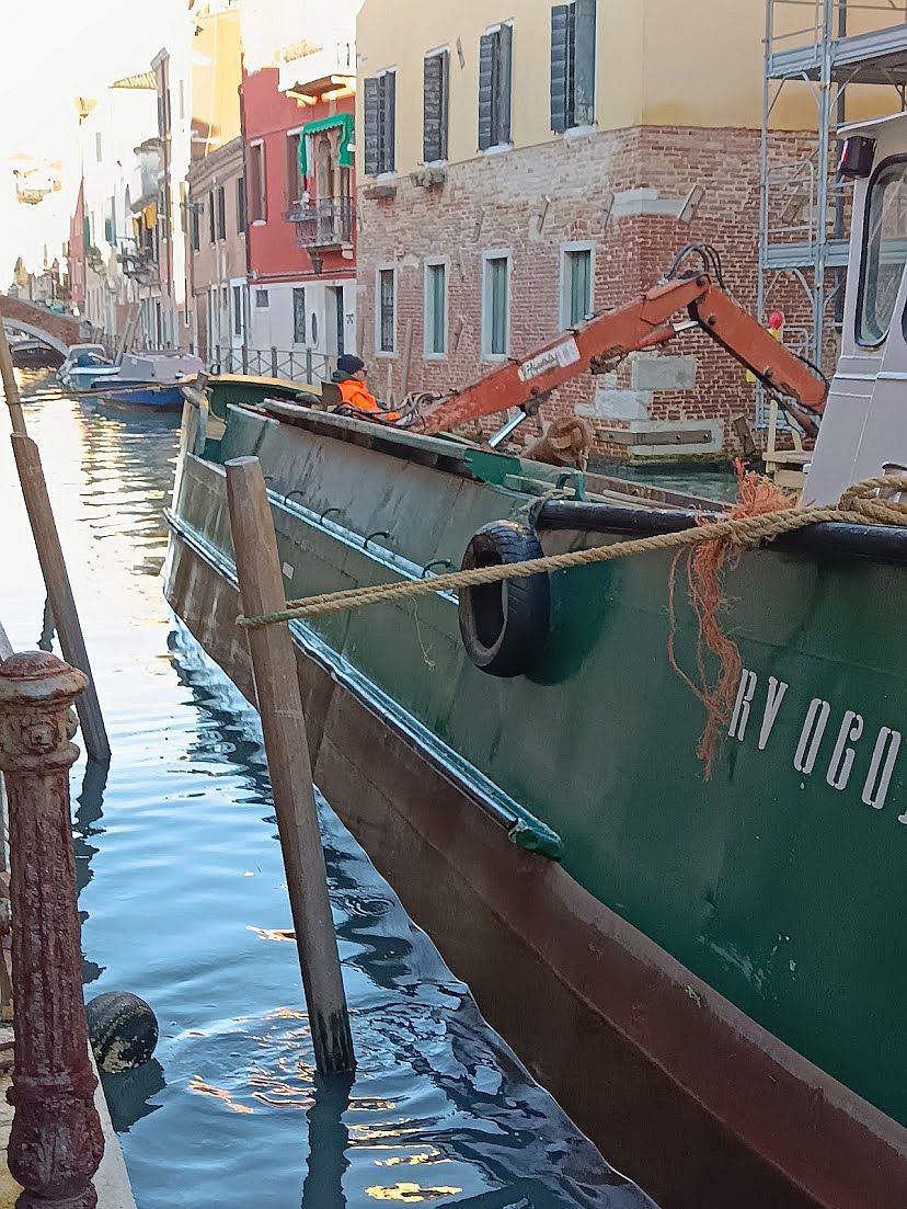
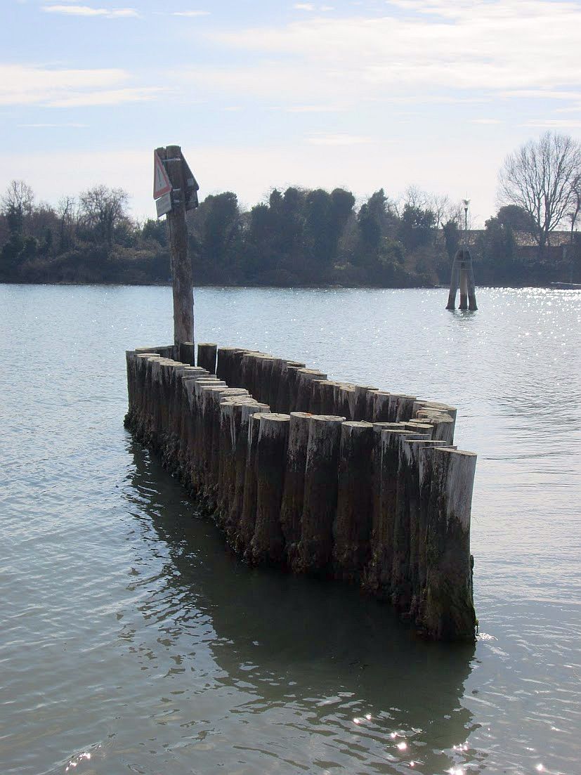
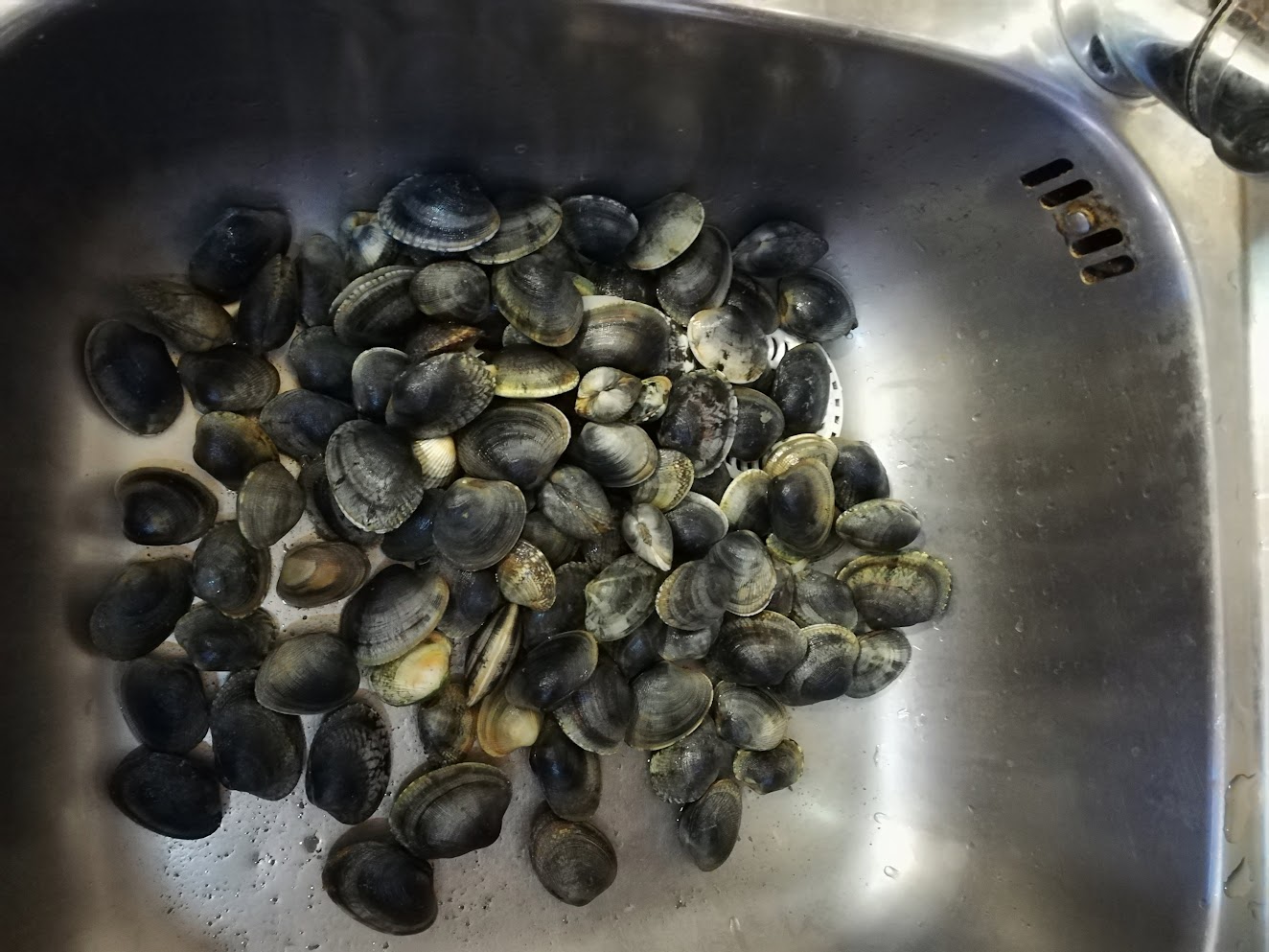
You could call it the lagoon’s base layer. There are places where there’s too much mud, mainly in the canals; it accumulates and creates problems for boats when the tide is low and, equally important, problems for buildings whose drains it has blocked, and so we have to take it away.
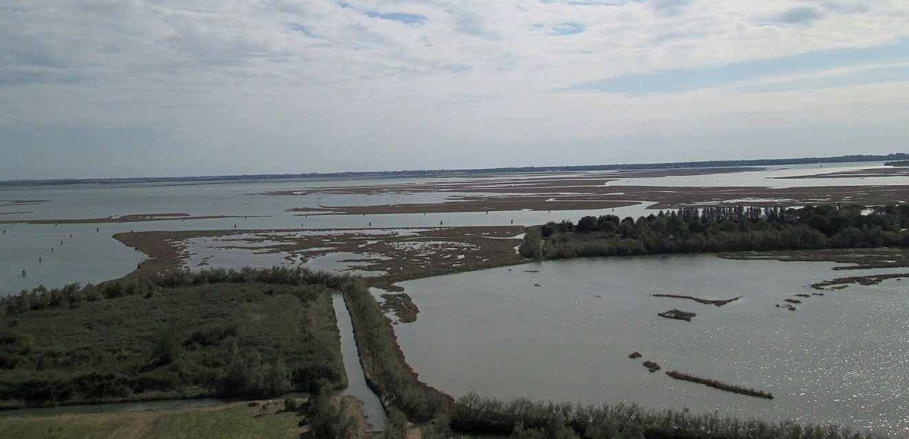
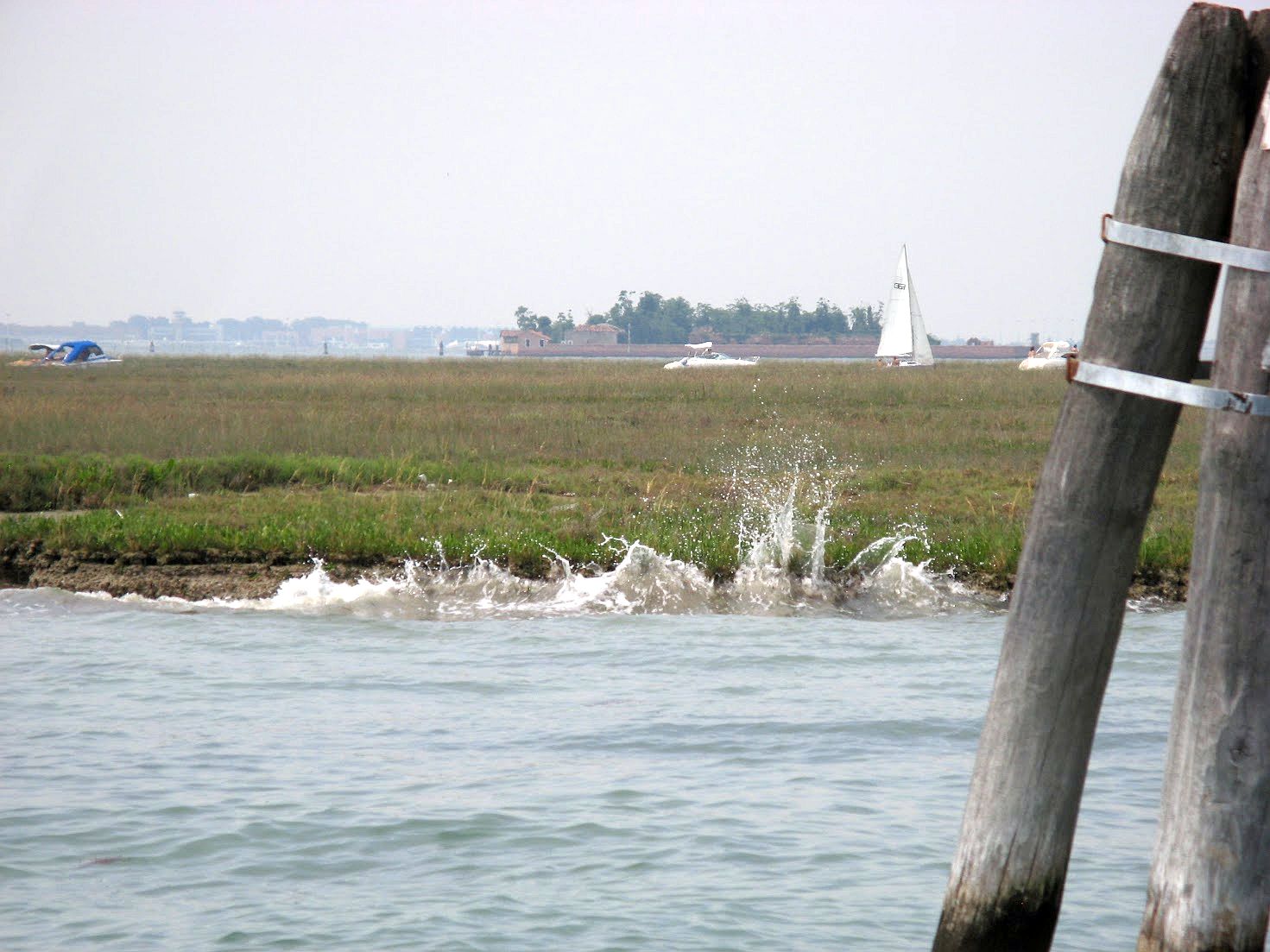
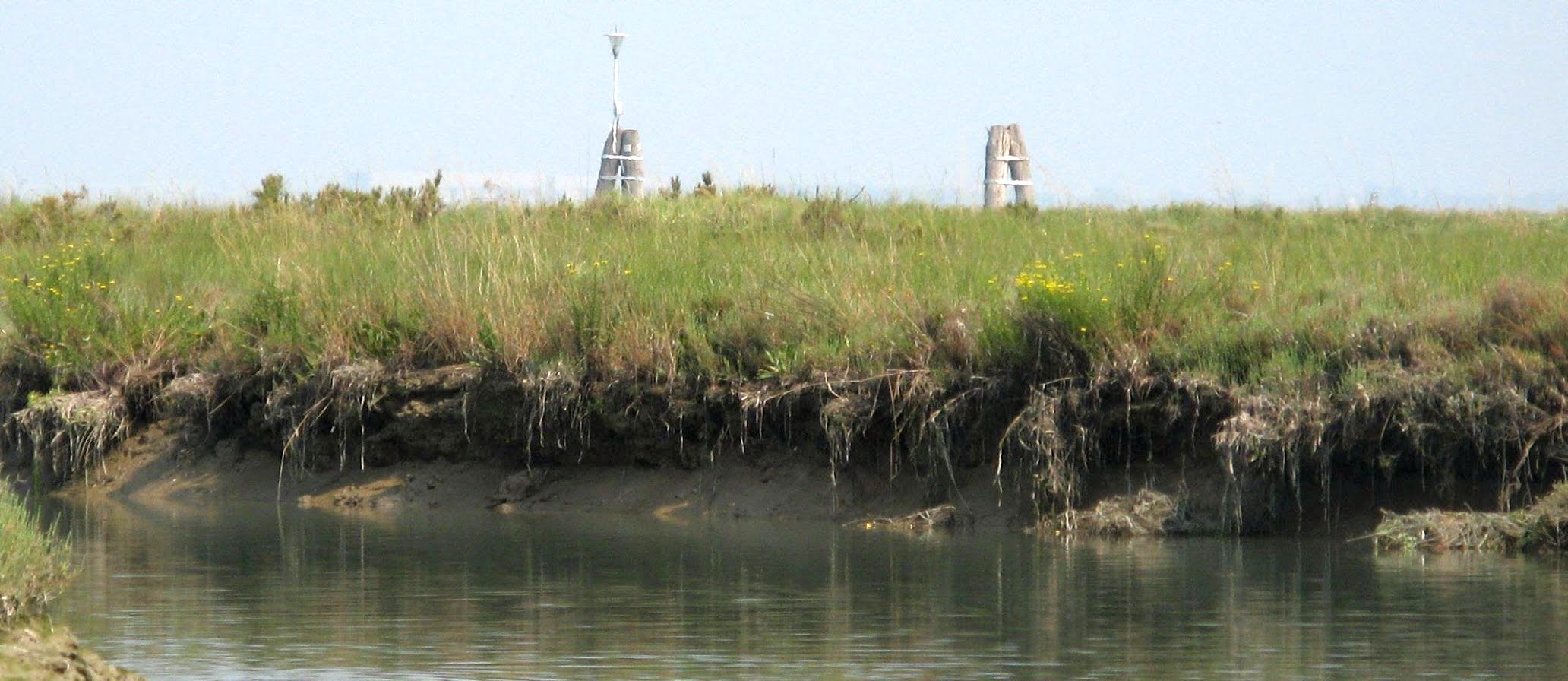
But there is an equal and opposite problem of there not being enough mud in places around the lagoon, where dredging has been heavy or, more frequently, where the motondoso (waves from motorboats) has loosened the soil, and the tide and waves have washed it out to sea. Waves that demolish the wetland marshes (barene) or, on the other hand, fill up channels, have been known for years to be wrecking the lagoon’s wrinkly underwater shape, smoothing it out and slowly turning it into a sort of bay of the sea. Bays of the sea are an entirely different ecosystem from lagoons, but no matter! Motors are indispensable for keeping the city going, and the lagoon is just going to have to suck up (so to speak) the consequences.
The 17th-century Venetians knew the lagoon dynamics intimately. Their survival depended on it. Fears of the lagoon silting up from the several rivers that flowed into it led them to an epic undertaking: From 1600-1604 they cut the river Po to divert it southward into the Adriatic.
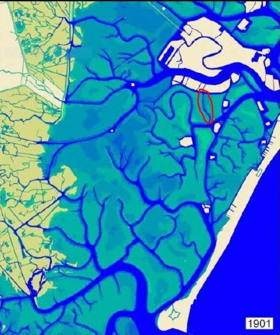
In 1993 it was decided to redistribute the quantities of mud in the city and lagoon: Simple, logical, effective, positive. Dredging proceeded and the mud was deposited in various locations where it was useful, or at least not problematic. In fact, moving mud around is far from a recent phenomenon — it’s been done many times over the centuries resulting in consolidations, expansions, and entire new islands. This assortment of maps showing the Morphological Evolution of the Lagoon of Venice from the XVI Century till today is very interesting. In the 20th century Tronchetto and Sacca Sessola, to name only two, rose from the lagoon bottom created with dredgings.
And so, in the fullness of time, the dredges were at work outside our door in 2021, and they were at it again just two months ago. All seemed to be going well, but suddenly we read that things have taken an unexpected turn. The mud is unusable!
The headlines have been blunt: “Unusable muds, the lagoon in crisis, the dredging has been stopped in the lagoon.” “The new Protocollo of 2023 for the sediments dug in the canals doesn’t work anymore because the parameters of ecotoxicity are too rigid.” “First they were considered clean and good for reconstructing the barene. But no more: Now there’s a risk of blocking also the dredging of the most polluted.”
This problem has come up literally in mid-dredge. It’s a little awkward to discover that the Protocollo of 2023 is invalid when the barges are full of mud, so now what? Is there a Plan B? “Strictly speaking, we don’t have one,” to quote CIA operative Gust Avrokotos in the film “Charlie Wilson’s War.” “But we’re working on it.”
So what changed all of a sudden? It’s that, as the headline noted, the standards are suddenly stricter as to what mud is classified as “ecotoxic” (either biological or chemical) and therefore where it can be dumped. (Don’t write in, I know that everything is chemical, looking at the universe. We’re roughly distinguishing here between chromium and E. coli.)
Nobody’s surprised to hear that there are toxic substances in the lagoon — just look at the Industrial Zone shoreline and draw your own conclusions. A few years ago the University of Padova and Ca’ Foscari in Venice studied some mollusks taken from the channel bordering the mainland. Researchers found that the bivalves contained a quantity of poisonous substances 120 times higher than in the rest of the lagoon.
So here we are. Where will the mud go?

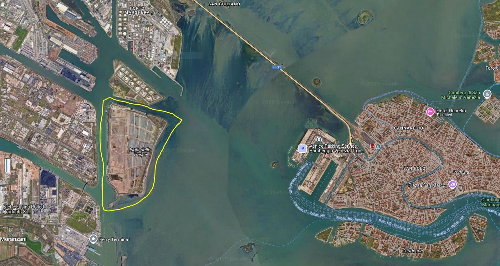
All muds are not created equal. Category A, the cleanest kind, is safe to put under the water, so it can be used “nourish” the shrinking barene. Other muds, the more toxic Category B and C, can’t be put back into the lagoon, no matter how worthy the reasons, and have to be banished to the Tresse island. And God forbid all these muds should become mixed together. Burning the mud is an interesting proposal, but it’s hard to agree on where to put the ash.
Also, the Tresse at the moment is running out of space. There have already been discussions about enlarging it, but quantity and quality, as often happens, are in conflict. Decisions lag. Bureaucratic, legal, logistical issues keep bumping into each other. Cost must be in there too, somewhere. The Morphological Plan of the lagoon was shot down in 2022 and nothing has been heard of it since.
So, back to the dredging at hand: After weeks of hardy gouging and hauling, the mud’s permission to land, so to speak, has been revoked. The Department of You Should Have Seen This Coming isn’t answering its phone.
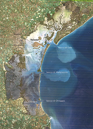
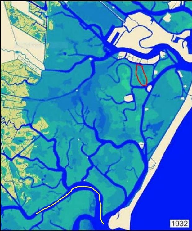
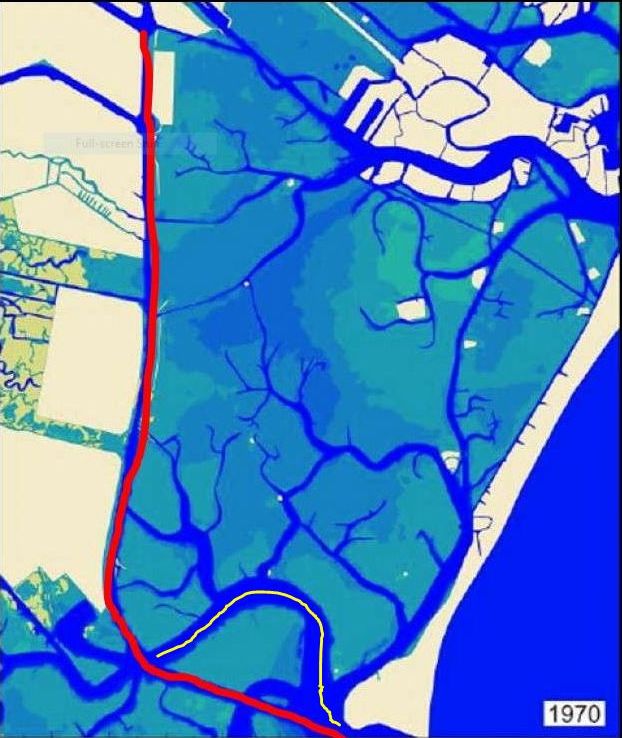
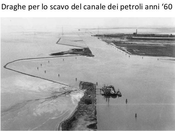
In the Thirties the Industrial Zone was being built; for Venice’s post-war economy it seemed like the greatest plan ever, and in many ways it was. In their great days (now past), the chemical refineries here were the largest in Italy. Oil and chemical industries require raw materials, and those require ships, and ships require reliable channels for passage. That broad, curving channel marked in yellow on the map above that enters the lagoon from Malamocco does not look like anything a big ship would want to navigate, and of course ships also need a waterway to reach the mainland port area. And so the Canale dei Petroli (“petroleum canal,” in honor of the expected tankers) was planned.
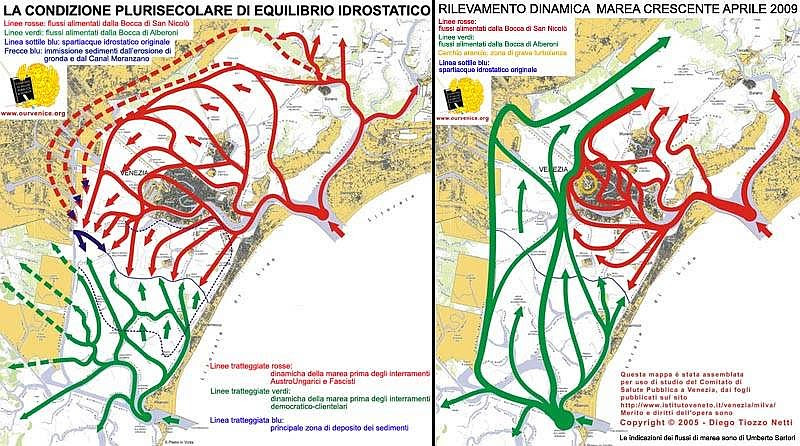
We’re looking at tide patterns, otherwise known as the hydrostatic equilibrium of the tides in the lagoon over many centuries.
LEFT PANEL: The solid red lines show the tidal pathway from the inlet at San Nicolo’. The solid green is the water entering from Malamocco (Alberoni). The thin blue line across the center of the lagoon emphasizes what we can see where the arrows meet, the point where the two incoming tides form the spartiacque, or “division of the waters.” The dotted red lines show tidal flow before the landfills created by the Austro-Hungarians (who left in 1866) and Fascists (1922-1943). The dotted green lines show the tide before the landfills made by the post-war “democratic-clientele governments.” The dotted dark-blue lines are the principal zones of sediment deposits, which makes sense considering the movement of the tides.
RIGHT PANEL: The pattern of the rising tide in 2009. The solid red line shows the pattern of the tide entering the lagoon from the inlet at San Nicolo’. The solid green line shows the tide entering from Malamocco (and, obviously, along the track of the Canale dei Petroli.) This graphic shows the effect of losing the mudbanks, natural channels and barene, smoothing out the lagoon bottom that used to be naturally uneven and knobbly.
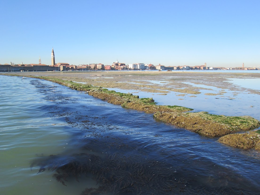
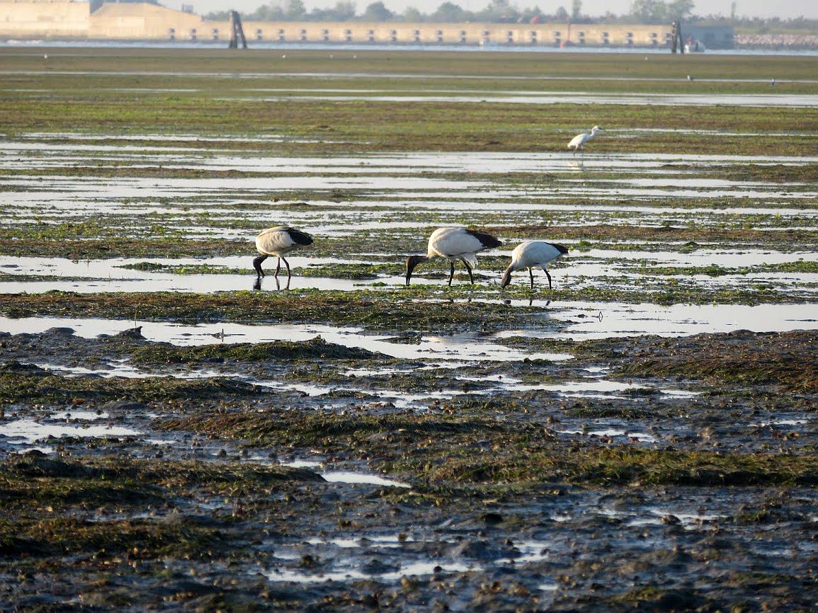
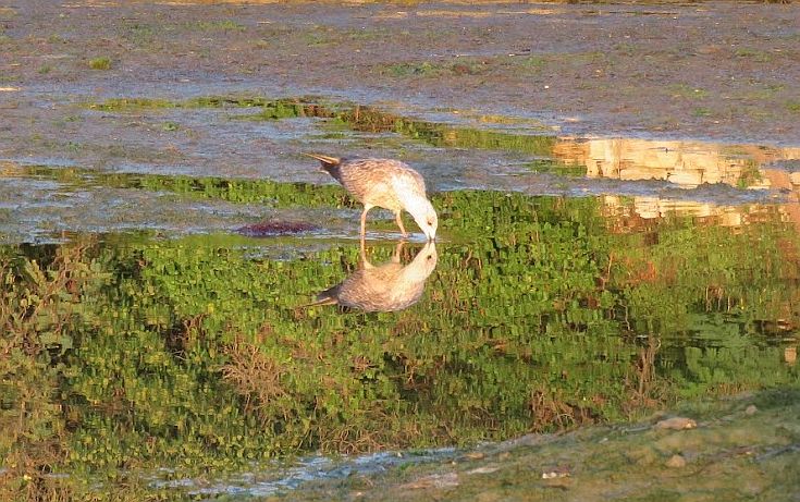

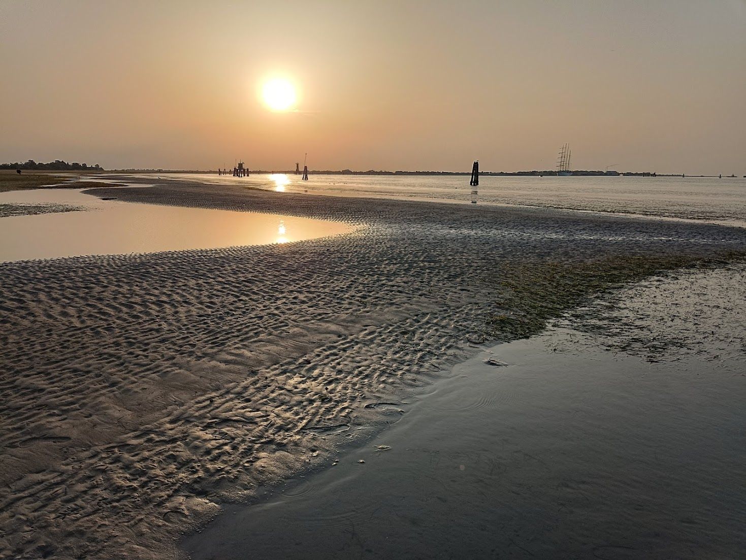
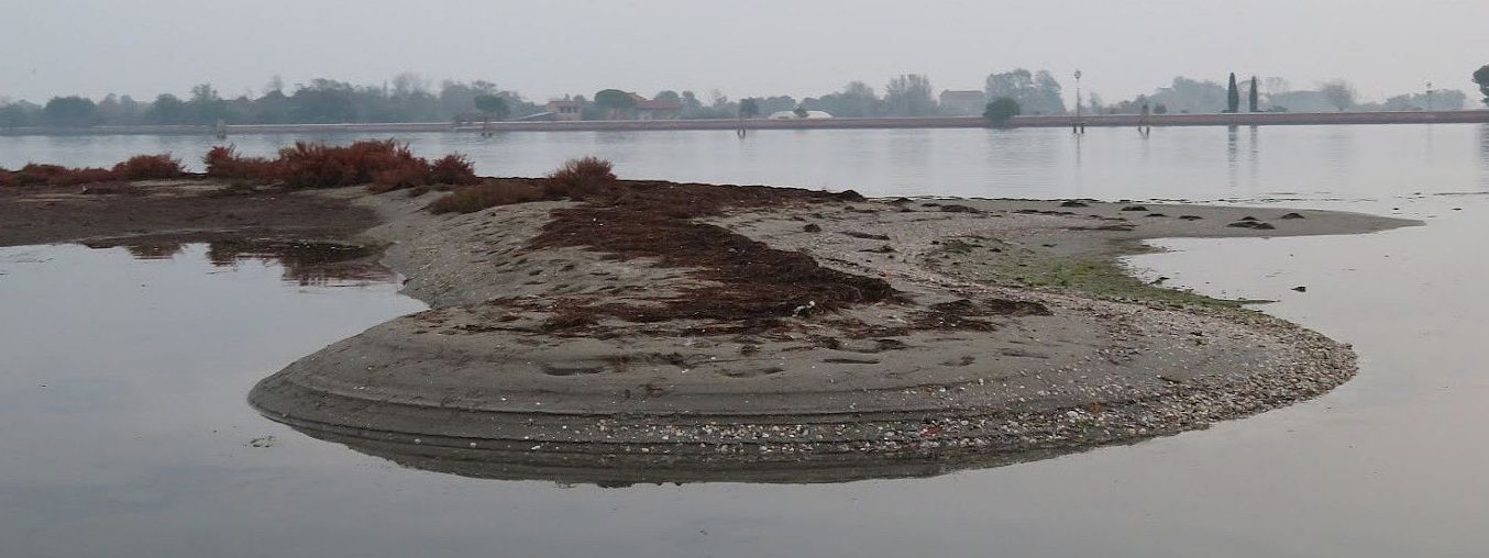
If you want a lagoon, you have to want mud. Otherwise you might just as well look at your bathtub.


 not only for taxis and barges but also some vaporettos and/or motoscafos. They have to change their normal routes because the high water prevents them from passing under certain bridges. There are alternatives by which they resolve this temporary dilemma, but it adds inconvenience to your own trajectory. As for heavy work boats and taxis, they either have to pick another route from A to B, or wait for the tide to turn. Tiresome, true, but hardly the stuff of calamity.


