All that mud has to go somewhere. We certainly don’t want it here.
After my post on dredging (which was far too long ago, I apologize), I’m attempting a return with some answers to the question several readers put to me: What happens to the mud that is dredged from the canals?
Bear in mind that Venice has dredged its canals many times over the centuries and deposited the mud somewhere it could be useful. For example, the island of Sacca Sessola was created from 1860-1870 with the mud dredged from the area of Santa Marta during the deepening of the canals of the maritime zone. And it is far from being the only one.
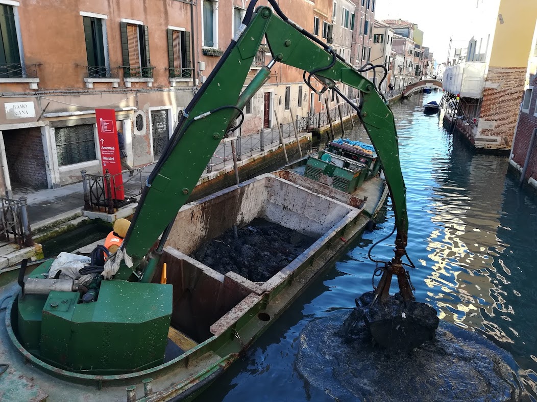
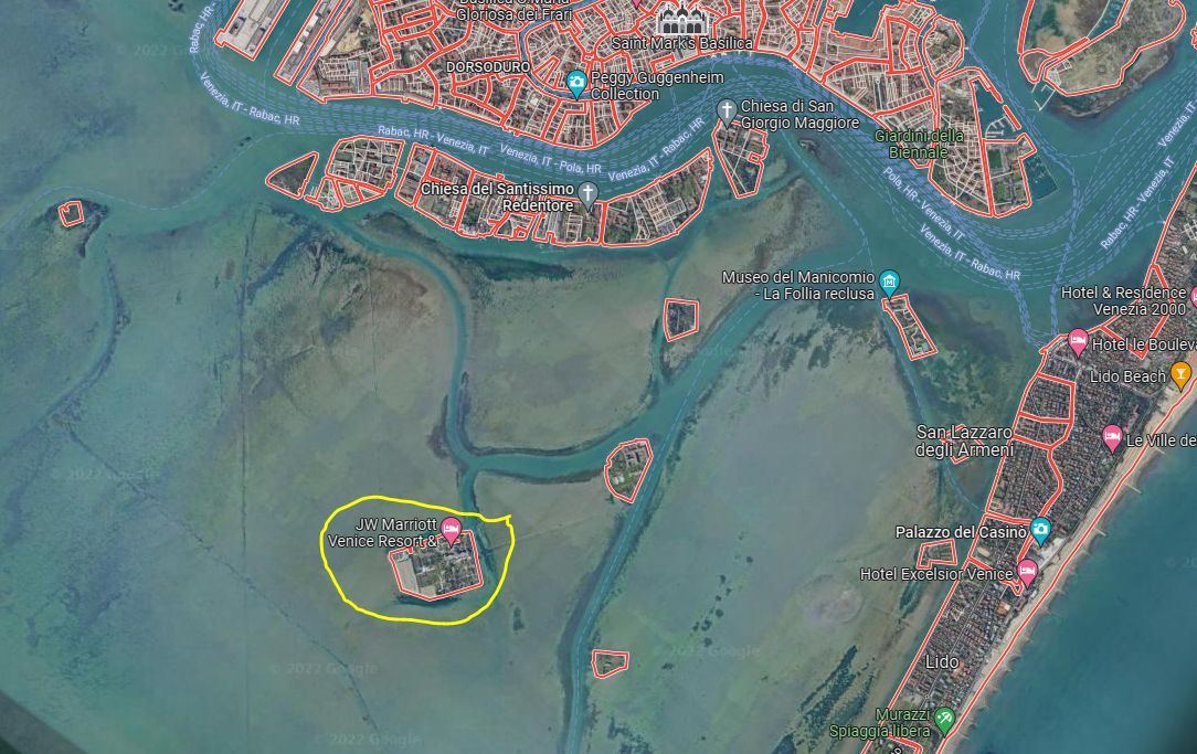
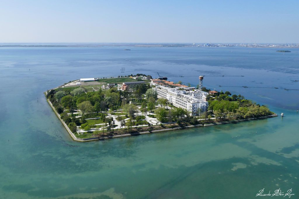
Sacca Sessola (so named because it was shaped in a way that reminded somebody of the common boat-bailing scoop) first served as a fuel depository facility, then converted in 1914 to house a large hospital dedicated to curing respiratory diseases, particularly tuberculosis. In 2015 the J.W. Marriott company turned the decrepit remains of the abandoned hospital into a five-star luxury hotel/resort, and renamed the island in its publicity as Isola delle Rose (Island of the Roses). Venetians continue to call it Sacca Sessola.Sacca Sessola is easy to identify from afar by its water tower. Like all the hospital islands, it was largely self-sufficient. Apart from the water, it had a stable full of cows, a bakery, laundry, and a lovely church. From the pictures on their website, it appears that the church is now a cocktail bar, or at least a venue for some elegant social event. (Photo: Riccardo Roiter Rigoni)
Small digression: “Sacca” (saca in Venetian) is often used to identify such places, but don’t confuse it with sacco, which means “bag.” A sacca is defined as “an inlet or cove of the sea, lake, river, or more precisely the bottom of an inlet or gulf. In geography, the accumulation of brackish water, very shallow, that is formed in sandy areas that separate the branches of a delta, from the resurgence of seawater from the subsoil.” End of digression.
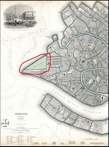
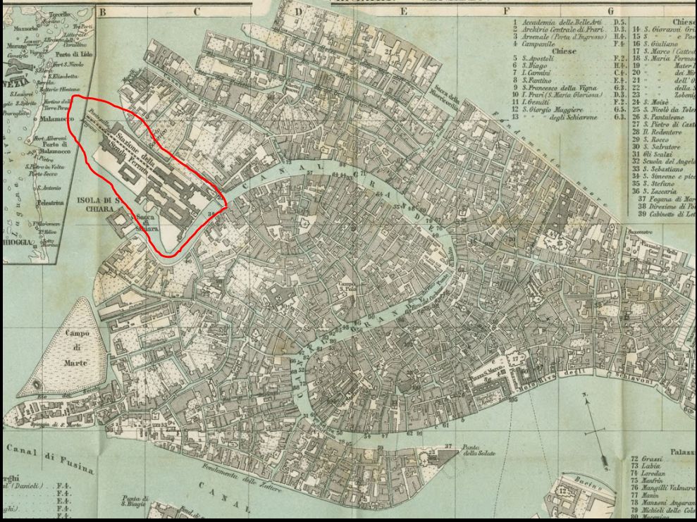
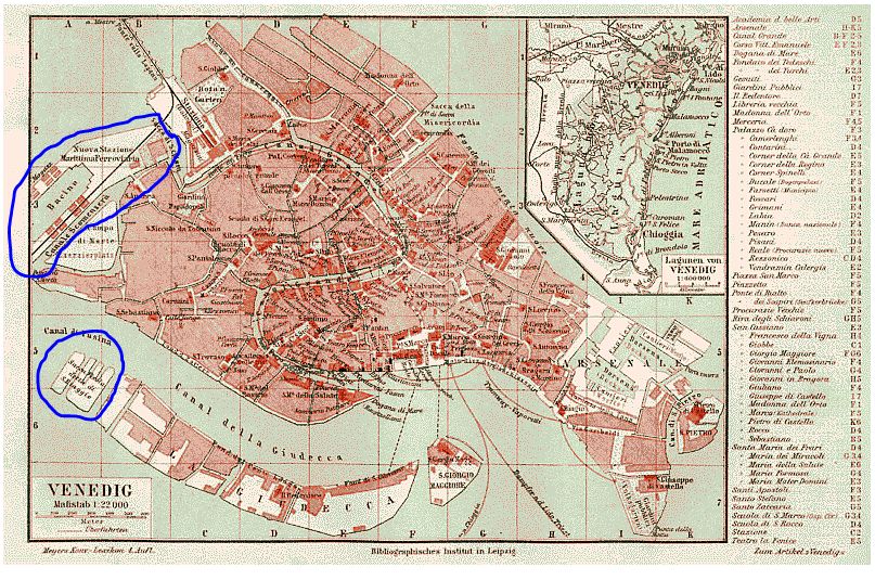
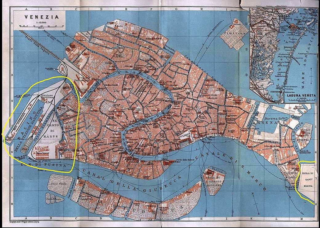
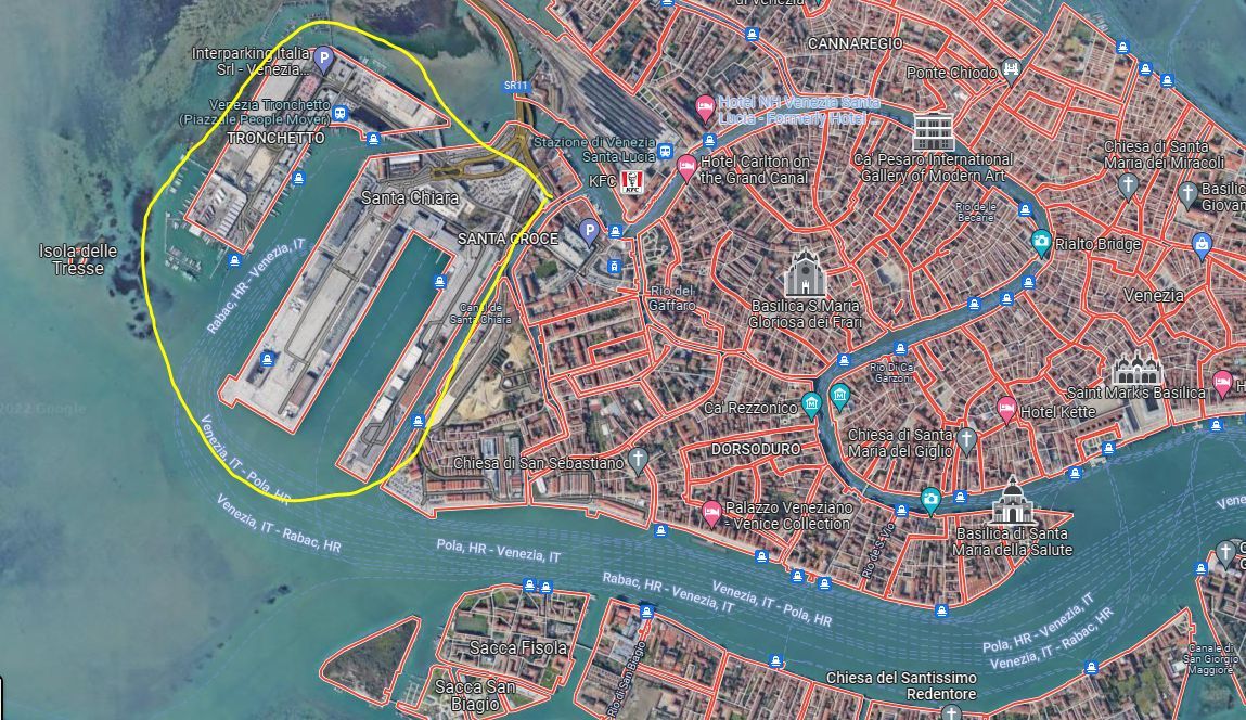
Ludovico Ughi’s map (1729) showed that Venice had plenty of empty spaces where land was later to be applied. Counterclockwise from top left we see the Sacca di Santa Chiara (just to illustrate what was meant by “sacca”), and the island of Santa Chiara. Then there is the expansion of the Santa Marta area where the red-circled area of water shown here was filled in for a military parade ground in 1838 by the Austrians, shown below. At the far right, water ripples where the island of Sant’ Elena now stands.Santa Marta 1838. The Austrians need a military parade ground, or Campo di Marte, so let’s wedge one in here.In 1869 the train station is visible in all its glory; notice that the island of Santa Chiara is still hanging on right next door.Big doings in 1888. Dredgings are dumped to form the new “Stazione Marittima,” or maritime terminal, clearly visible in the upper left corner and thereby (obliterating? incorporating?) the island of Santa Chiara. In the same year, the Giudecca has been elongated by the addition of Sacca Fisola and Sacca San Biagio. Even though the Austrians departed in 1866, the Campo di Marte on this German map is still labeled “Exerzierzplatz” (exercise place).In 1913 the area at Santa Marta is now labeled “Ex Campo di Marte” and the lower half of the land is occupied by warehouses. The black lines stretching along the bridge and down to the Stazione Marittima and the waterfront on the Canale di Fusina were railway tracks bringing freight trains directly to the ships. At the easternmost edge of the city we now see “Isola di Sant’ Elena,” developed in the 1920’s on land that had been built there as another military parade ground. At least they found a useful second life after the Austrians left.The Stazione Marittima was enlarged in 1958 by an extension cleverly named Tronchetto. It does sort of look like an elephant’s trunk. Less fancifully, it is also known as “Isola Nuova” (new island).
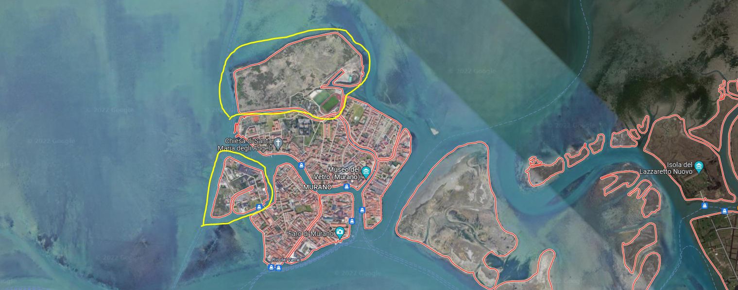
Murano, a natural grouping of lagoon islands, has been amplified with dredgings over the years; if you look at Google Maps (satellite view) you can easily locate Sacca Serenella, a sort of industrial zone to which no tourist would be lured. Murano has also grown on its northern perimeter by the addition of yet another island, mostly barren at the moment, where the Centro Sportivo San Mattia is located.
Murano. Sacca Serenella is the lower island, and the upper barren land has only partially been reclaimed by a sports facility that includes state-of-the-art bocce courts.
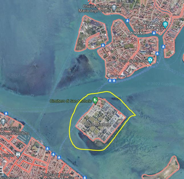
The cemetery island of San Michele has undergone quite an expansion over the past few years, thanks to dredgings from the city and environs. Puts a perfect, if slightly queasy, spin on the old “dust to dust” trope. I wonder if you could specify in your will that you want to be buried in the mud dug up from the canal nearest to your home.
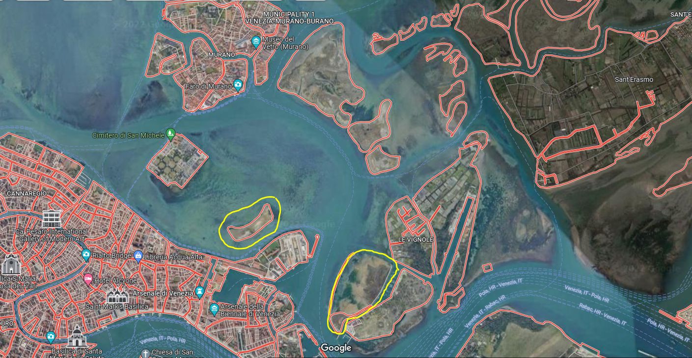
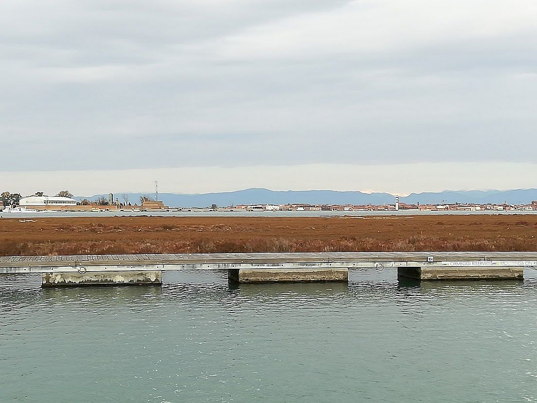
The current island was originally two — San Michele and San Cristoforo. Napoleon decreed the establishment of a municipal cemetery. as opposed to the local graveyards near parish churches. More space is constantly needed, so keep those dredgings coming.Two steps, so to speak, from San Michele is a reconstructed barena, painstakingly built up to replace one that the motondoso had completely eroded. Considering how many motorboats roar past every day, and even more in the summer, I’m not betting that it will not eventually meet the same fate. To the right is the larger barena created just a few years ago more or less at the same time as the Vento di Venezia marina. It used to be a lovely stretch of water to row across on the way to the Vignole, but Lord knows we need more barene.
When there is a large quantity of mud to be deposited, it is sprayed from enormous barges through high-powered tubes, specifically to form new barene (marshy islands). This process was quite a spectacle for a while during the construction of the “Vento di Venezia” marina at the island of the Certosa.
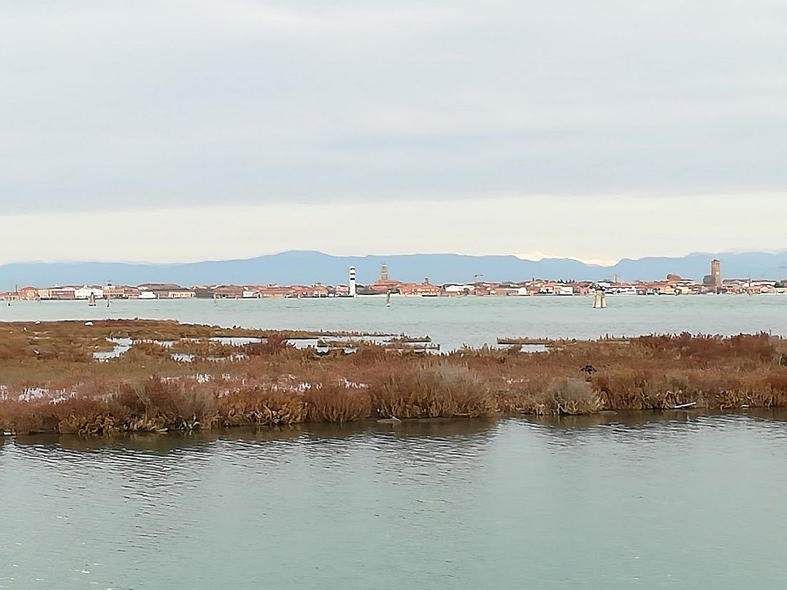
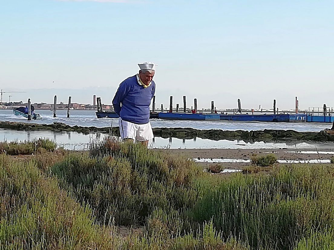
Looking across the recreated barena from the moorings at the Vento di Venezia.Not visible here are the barely submerged bags of stones that defend the fragile muddy islets from the lashing of the motorboat waves.The barrier is easier to see in this view. Lino went exploring among the saltwort (Salicornia europaea). We often see birds here, sometimes nesting — egret, beccaccia di mare (Haematopus olstralegus), cavaliere d’Italia (Himantopus himantopus). The random seagull.
Unhappily, sometimes the mud is poison. I’m not picking on Murano, but canals near the glass furnaces are known to contain arsenic and a few other chemicals not conducive to health. The sediments along the lagoon edge by the Industrial Zone are loaded with heavy metals — pick your favorite, it will be there. Sometimes illegal clammers go there at night, sell the clams, they’re sold to restaurants, etc. You can imagine.
Because the provenance of the mud matters, there is a system by which it is analyzed and classified and, if necessary, treated to render it harmless. This is more than usually important if it’s being sold to farmers to enrich their fields. I haven’t researched the system(s), so please don’t ask me. The point is that they exist.
The mud of Venice. You probably wouldn’t call it poetic, but it’s just as important as the water.
Contains information related to marketing campaigns of the user. These are shared with Google AdWords / Google Ads when the Google Ads and Google Analytics accounts are linked together.
90 days
__utma
ID used to identify users and sessions
2 years after last activity
__utmt
Used to monitor number of Google Analytics server requests
10 minutes
__utmb
Used to distinguish new sessions and visits. This cookie is set when the GA.js javascript library is loaded and there is no existing __utmb cookie. The cookie is updated every time data is sent to the Google Analytics server.
30 minutes after last activity
__utmc
Used only with old Urchin versions of Google Analytics and not with GA.js. Was used to distinguish between new sessions and visits at the end of a session.
End of session (browser)
__utmz
Contains information about the traffic source or campaign that directed user to the website. The cookie is set when the GA.js javascript is loaded and updated when data is sent to the Google Anaytics server
6 months after last activity
__utmv
Contains custom information set by the web developer via the _setCustomVar method in Google Analytics. This cookie is updated every time new data is sent to the Google Analytics server.
2 years after last activity
__utmx
Used to determine whether a user is included in an A / B or Multivariate test.
18 months
_ga
ID used to identify users
2 years
_gali
Used by Google Analytics to determine which links on a page are being clicked
30 seconds
_ga_
ID used to identify users
2 years
_gid
ID used to identify users for 24 hours after last activity
24 hours
_gat
Used to monitor number of Google Analytics server requests when using Google Tag Manager