Reader Christopher has written the following Comment: I am perplexed and maybe you can help me. The Chiesa di Sant’Elena was built in as early as 1060 by some accounts. Saint Helen was brought to the lagoon and interred in her eponymous church in 1211. It’s curious that the church is not shown on the earlier maps. Any idea why this might be? ….
If I understand your question to be why isn’t the church dedicated to Sant’ Elena shown on maps prior to the arrival of her remains, I can only reply that I think there could be several reasons.
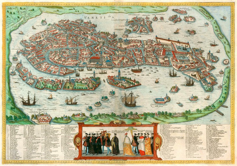
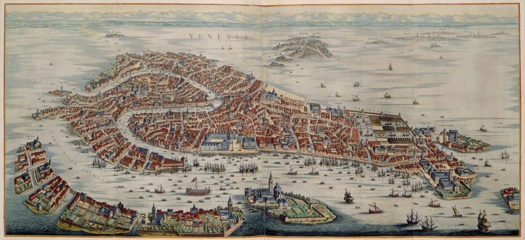
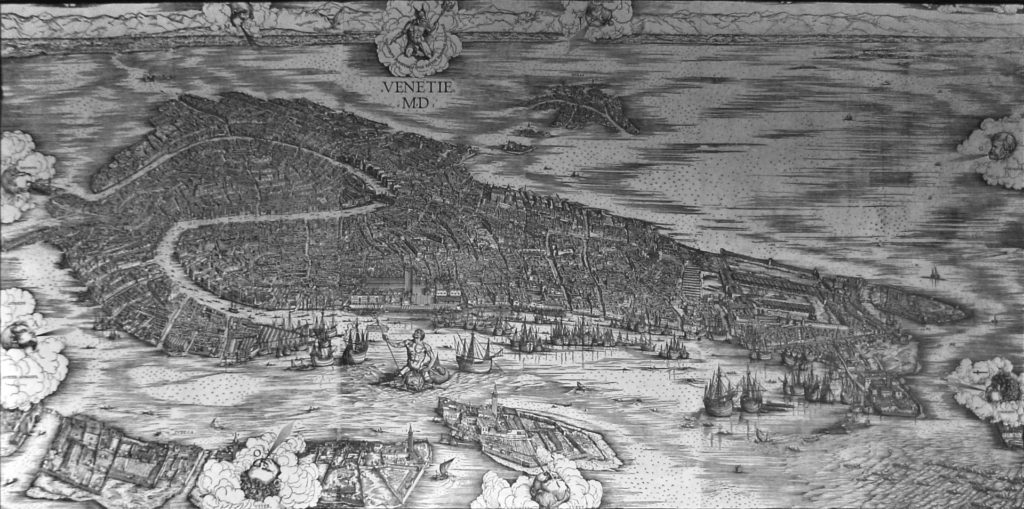
One reason is that there aren’t many maps of Venice prior to 1211, and those that do exist are not very detailed. Even 17th-century maps don’t show everything. Also, Venice has plenty of churches named for saints whose remains are not in residence. There’s no reason why a mapmaker with limited space would choose to show a church if it didn’t contain its tutelary saint. Which raises the interesting question, which I had never considered till now, as to who decides what to include in a map and what to leave out.
As to the dates you mention, “…the first chapel dedicated to St. Helen was built in 1028 and entrusted to the Augustinian order, which constructed also a convent. In 1211 the Augustinian monk Aicardo brought to Venice from Constantinople the presumed body of the empress. Following which the Augustinians enclosed the chapel within a larger church.” More confusion arises from the statement that there was a “hospital” dedicated to her, built in 1175 — 36 years before the saint arrived — maintained by the Augustinian order, for the care of the poor.
In the 15th century the convent and the church passed to the Benedictine monks, who rebuilt it in 1439. A century later, in 1515, the church was consecrated by the bishop of Aleppo and became an important religious center, with vast property and notable works of art. So evidently three centuries, all told, had to pass before her church (or let’s just say “she”) became sufficiently important to warrant identified inclusion on a map.
These sources don’t identify where the church was located, but I’m going to suppose it was on the island of Sant’ Elena.
Some maps, from the 1400’s onward, show at least part of an island floating off the eastern shore of Castello, just below Olivolo, where the church of San Pietro di Castello stands. So something was there, even if it isn’t identified. Yet if her eponymous original church was there, it does seem strange that so many cartographers didn’t show it, or if they did, why they didn’t always label it.
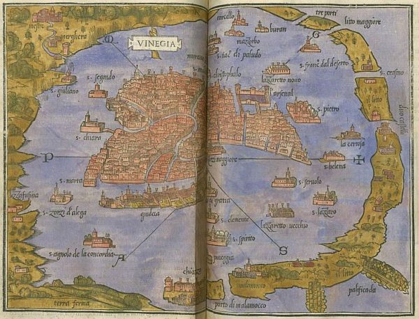
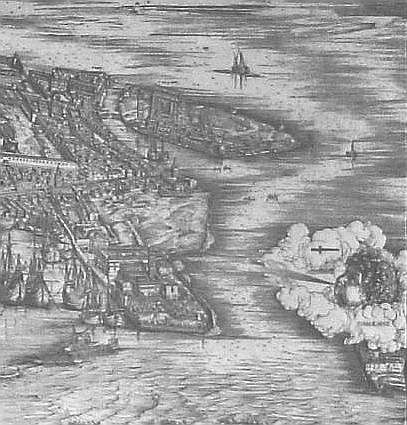
I think it’s evident that no map except Dei’ Barbari’s (1500) could claim to show everything. A good number of maps show only a smattering of churches, even though we know that there were many more. But he gives a only glimpse of the island, going so far as to cover half of it with a cloud-bedecked cherub. And yet the island, not to mention the mother of the Emperor Constantine, were hardly a secret.
If I ever find out why she was snubbed so often, I’ll let you know.